This is the third article in a series relating the history of Lake Lanier and Buford Dam and coinciding with a special exhibit on Lake Lanier presented by the Sugar Hill Historic Preservation Society at the city’s history museum. Thanks to outstanding public response, the exhibit has been extended until the end of September.
Thousands flocked to the groundbreaking of the new reservoir that had been championed as the future savior of Georgia’s economy in 1950. Three saddle dikes and the spillway were constructed at various points along what is now Buford Dam Road in Forsyth and Gwinnett counties. Fast forward to October 1951 when work began on the actual powerhouse structure starting with the forebay excavation.
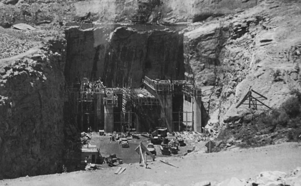
The powerhouse structure was to be carved out of the granite hillside in Forsyth County. The first part to be constructed as part of the powerhouse/intake structure was the forebay. A forebay is a channel or canal that is excavated that allows water to flow through the intake structure of the powerhouse. The process of constructing the forebay and the tailrace (the channel below the dam) resulted in a large quantity of granite rocks. Those rocks would eventually be used to line the lakeside of the earthen dam, saddle dikes and bridge abutments, according to “Lake Sidney Lanier ‘A Storybook Site’: The Early History & Construction of Buford Dam” by Robert David Coughlin. Coughlin was able to locate in a 1957 edition of the Gainesville Daily Times the cost to excavate the forebay. Groves, Lundin and Cox Inc. of Minneapolis, Minnesota, was paid $2,836,712 on May 25, 1951, for the job.
In late 1952, the excavation of three penstocks that are the long channels bored out of the solid granite that carries the water to the turbines in the powerhouse were in the works. The water levels of Lake Lanier are controlled by the two main penstocks located near the bottom of the intake structure at 280.18 meters above mean sea level or msl ¹ and 286.89 meters above msl. Diamond-tipped drills were used to excavate the tunnels of the penstocks.
Penstocks one and two are full tunnels that run from the forebay to the tailrace. However, penstock No. 2 has a smaller penstock (penstock No. 3) that branches off of it halfway between the forebay and tailrace sides.
The sluice, another channel bored out of the granite allowing water to flow from the reservoir through the intake structure during times that water is being released without generating power, is being excavated during the same period as the two penstocks during 1952 and 1953.
Once the penstocks and sluice tunnels were excavated, steel reinforcements were installed late 1953 and early 1954 to make way for concrete work to begin on the actual intake structure. The intake structure consisted of three 198-foot towers called monoliths. The intake structure rests against the face cut of the forebay (lakeside) with the base of the intake at the elevation of 911.0 and the top at elevation 1,106.00. Once the lake was filled to full pool, anyone looking at the structure would only see a small amount of the structure visible above the water line. The base of the structure is under about 150 feet of water today.
The monoliths were designed to hold the large metal gates that are opened and closed to control the flow of water from the reservoir into the Chattahoochee. Inside the penstocks are trash guides that house trash screens. The purpose of those screens is to keep debris from getting sucked into the turbines and causing major damage to the machinery.
On July 1, 1954, work on the intake structure came to a halt when iron and steel workers from all over the area went on strike. It would be several months before the workers of the trade union returned to work on the structure. The intake structure was near completion on April 28, 1955.
J.A. Jones Construction Company of Charlotte, North Carolina, built the intake structure for the sum of $2,011,402.
The fourth article in the series on the early history of Buford Dam and Lake Sidney Lanier will focus on the construction of the powerhouse and earthen dam.
¹ United States Environmental Protection Agency, Region 4 (July 1979) Limnological Investigation Of Lake Sidney Lanier With Special Reference To Selected Heavy Metals

